 ⛺️ Campsite
La Panza Campground
Campsite · California
+ Add a photo
· free account
About this stopover
USDA Forest Service campground, 7 sites
Overview
La Panza Campground is full of opportunities to relax or explore the forest. Nearby is Machesna Mountain Wilderness where hiking, hunting and horseback riding are popular. Off-high vehicle (OHV) recreation is also plentiful in the area.Recreation
La Panza Campground is best enjoyed by campers who prefer a rugged outdoor experience. The Pozo La Panza 18,867-acre area has approximately 44 miles of routes that vary from sandy washes to a ridgeline route including a section known to expert OHV riders as the Stair Steps. With proximity to OHV trails, this spot will keep the adrenaline junkies enthused as well as the avid hiker. Bring your bikes, motorcycles, ATVs and four-wheel drive vehicles to enjoy the amazing trail experience!Facilities
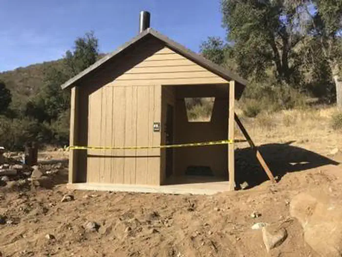
This campground is open daily and year-round. There are 15 single and spaciously situated campsites ideal for tenting, and moderate RVs under 16 ft. Campfires are allowed only in designated fire rings. You should plan to be completely self-sustainable for the duration of your trip. There is no potable water (drinking water) or electricity onsite. There is no dump station. This is a "dry" campground with five vault toilets. The road into the campground ends cul-de-sac style, but with adequate turn around.Natural Features
La Panza Campground is situated in a canyon setting, encompassed by a gathering of established oak trees, and accented by a seasonal creek. Fox, coyote, road runner, deer, wild pig, jack rabbit, quail, and very rare black bear, all visit this area.Nearby Attractions
Lakes, trails, beautiful views, biking, hiking and off-road vehicle riding are all within minutes of the campground. The nearest shopping is 29 miles in Santa Margarita.Location
Plan your trip with Campercation
25,000+ stopovers across 6 countries. Browse free. A free account lets you:
- Save stops and find them on every device
- Build trips along your route
- Review places and add photos
Already have one?
Sign in
Reviews
No reviews yet. Your tip helps the next visitor find a good stop.
Review this place
Free account.
Sign in
Nearby places
Browse California →
Book on Recreation.gov →
Opens Recreation.gov in a new tab. They take the booking, not us, and we earn nothing on it.
Data source: Recreation.gov View on the source site Information last updated 25 February 2026
Free to browse. Free to save.
Create a free account to save stops and plan trips. PRO adds the full fuel price list, unlimited trips and no ads.
Check your email
We have sent a confirmation link to .
Confirm your address and sign in, and we will bring you back to this page.