 ⛺️ Campsite
Crook Campground
Campsite · Arizona
+ Add a photo
· free account
About this stopover
USDA Forest Service campground, 2 sites
Overview
This group campground is situated in a tall ponderosa pine forest, just down the road from the popular Woods Canyon Lake in north central Arizona. The shaded campground is a nice hideaway for large groups with opportunities for boaters, anglers, hikers, families and photographers.Recreation
Popular activities include trout fishing, hiking, boating, cycling, horseback riding, and photography. Woods Canyon Lake is the most popular of four lakes in the Rim Lakes Recreation Area. Woods Canyon Lake only allows electric boat motors. The paved Meadow Trail borders Crook Campground and will bring you about 1 mile north to Woods Canyon Lake or one quarter mile south to the The Rim Lakes Vista and Rim Trail is just a quarter mile from the campground and leads to spectacular views of the Mogollon Rim and surrounding area.Facilities
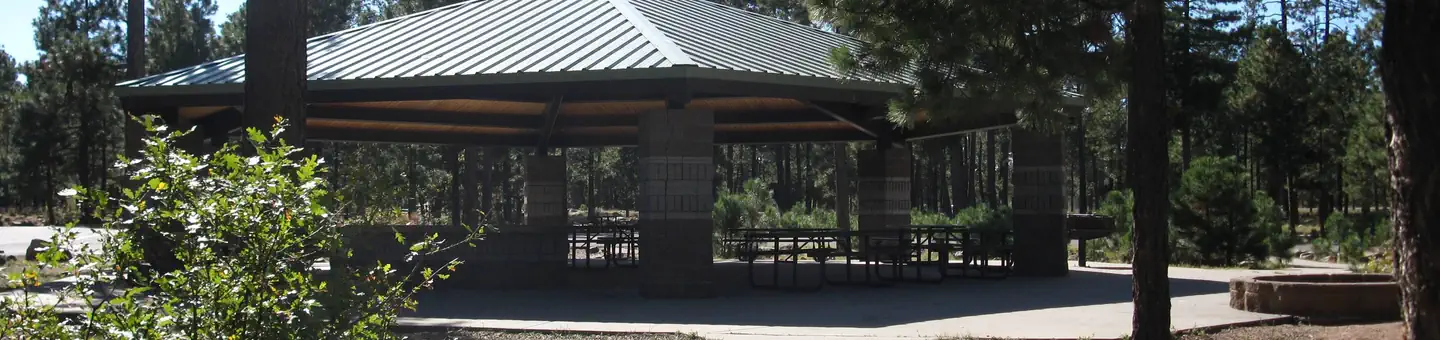
The campground is arranged in two loops in a cul-de-sac design. Each has a group area that can host up to 110 campers and 26 vehicles (parallel parking only). The sites can accommodate both RVs and tents, though some areas are less suited for tent camping. A picnic shelter is located in the middle of the group use area. Groceries are available at the Woods Canyon Store, and a dump station is located near the park. Firewood is available for sale at the store and onsite.Natural Features
The campground is situated a ponderosa pine forest at an elevation of 7,500 feet. Wildlife viewing includes birds, squirrels, deer and elk. Hikers who venture onto nearby trails are afforded expansive views of the land beneath the Mogollon Rim. The Mogollon Rim, pronounced by locals as "muggy-own," is a 200-mile long escarpment in northern Arizona that ranges between 5,000 and 7,000 ft. in elevation and serves as the geographical divide between the cool high country above and the hot, dry desert below. Summer temperatures can be very pleasant because of the elevation. However, the rainy season often brings afternoon thunderstorms from late June through August. Visitors should come prepared for rain and cool nighttime temperatures.Contact Info
For facility specific information, please call (928) 535-0181.Nearby Attractions
Gas, food, and groceries are available in Forest Lakes 9 miles east. The nearest full service community is Payson, Arizona, 34 miles west on Highway 260. Visitors can explore endless vistas and take part in many outdoor activities in the surrounding Apache-Sitgreaves National Forest, which encompasses 2 million acres of magnificent mountain country in east-central Arizona and New Mexico.Location
Plan your trip with Campercation
25,000+ stopovers across 6 countries. Browse free. A free account lets you:
- Save stops and find them on every device
- Build trips along your route
- Review places and add photos
Already have one?
Sign in
Reviews
No reviews yet. Your tip helps the next visitor find a good stop.
Review this place
Free account.
Sign in
Nearby places
Browse Arizona →
Book on Recreation.gov →
Opens Recreation.gov in a new tab. They take the booking, not us, and we earn nothing on it.
Data source: Recreation.gov View on the source site Information last updated 25 February 2026
Free to browse. Free to save.
Create a free account to save stops and plan trips. PRO adds the full fuel price list, unlimited trips and no ads.
Check your email
We have sent a confirmation link to .
Confirm your address and sign in, and we will bring you back to this page.